Environmental Services
THE HYDROPREDICTIONS OFFER
WATER MANAGEMENT
Climate-change induced extreme precipitation events and sea-level rise are resulting in both inland and coastal flooding in some areas, while increasing temperatures are causing water scarcity in others. HydroPredictions can help you plan for the future by identifying vulnerable areas and simulating possible solutions.
Sea-level rise and storm surge inundation mapping
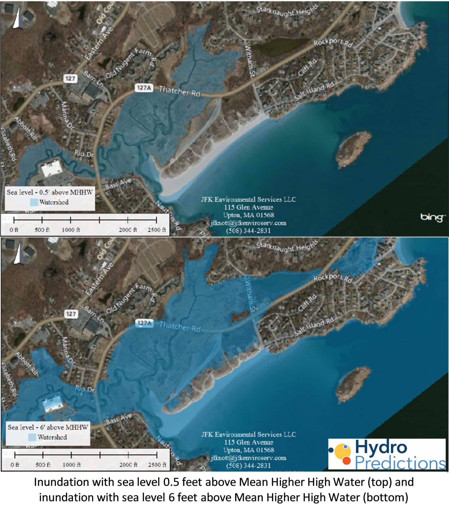
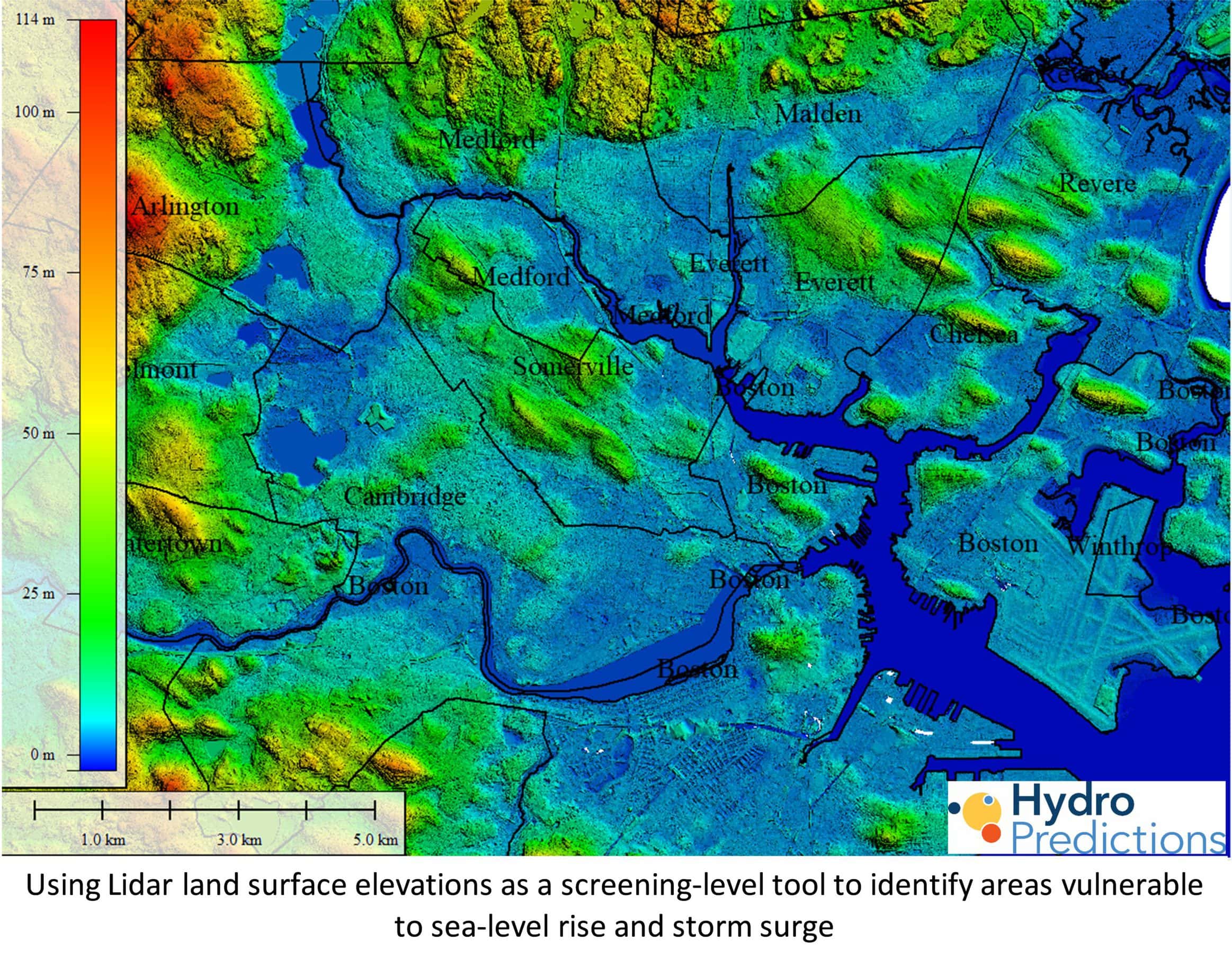
The first step in preparing for sea-level rise and storm surge is inundation mapping. This identifies the areas and infrastructure at risk from increased frequency of tidal flooding and storm damage.
HydroPredictions can do inundation mapping for you or update previously completed maps with the latest sea-level rise projections. Do you want to estimate costs and benefits of adaptation strategies to avoid damages from sea-level-rise induced coastal flooding? We can help.
Modeling sea-level-rise induced groundwater rise with implications for coastal infrastructure and water quality
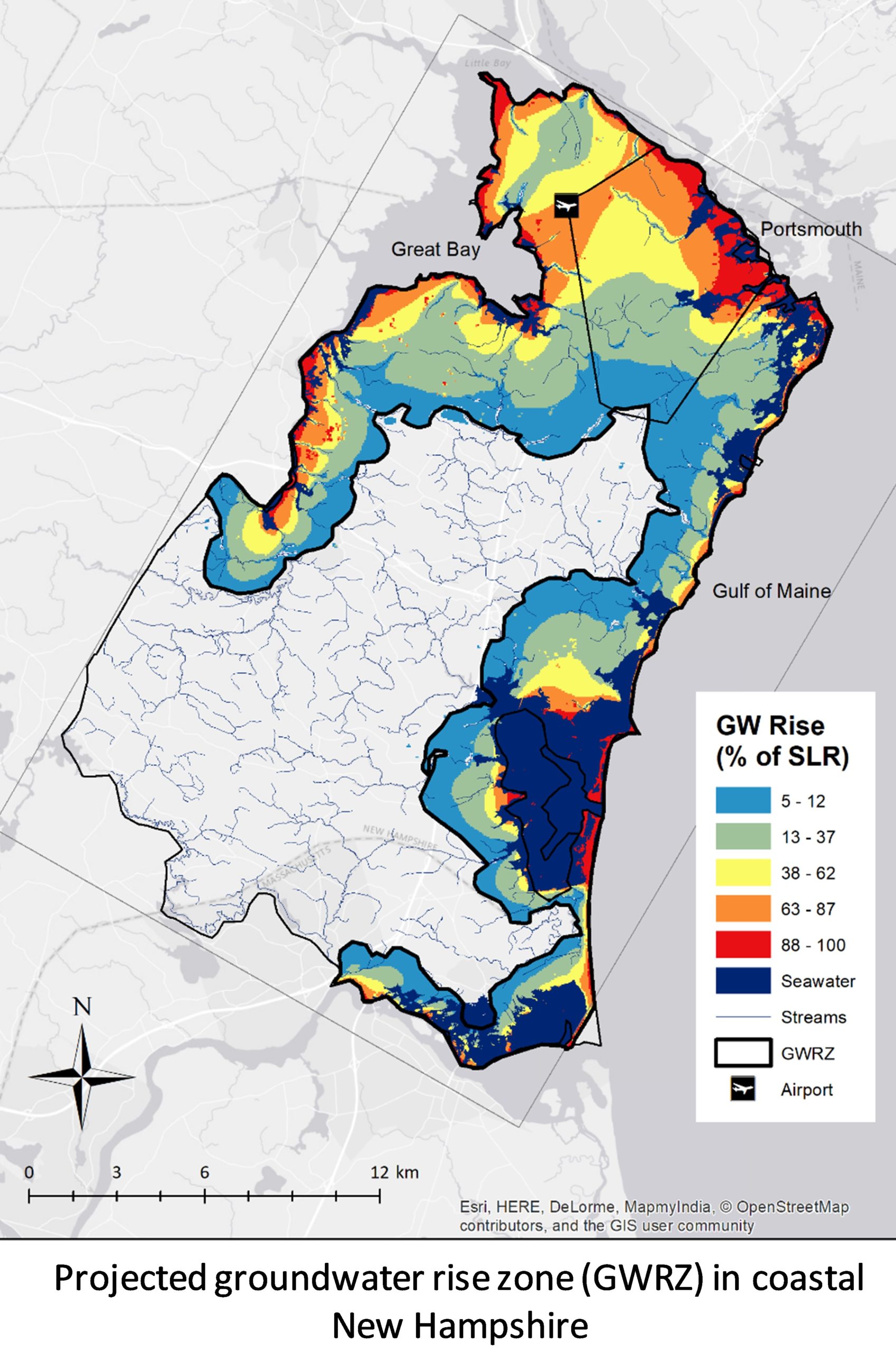
Tidal-water flooding is known as a consequence of sea-level rise and storm surge. A lesser known phenomenon with large potential consequences is rising groundwater levels caused by sea-level rise. Rising groundwater can cause premature failure of coastal infrastructure and damage historic structures. It can mobilize contaminants from septic systems and hazardous waste disposal areas. Sea-level rise can also increase saltwater intrusion into drinking water wells in some areas near the coast. HydroPredictions constructs groundwater models to investigate the effect of sea-level rise on groundwater and to identify infrastructure, natural resources, and water supplies that will be harmed without adaptation planning. We then use the model to simulate adaptation options to guide policymakers and decision-makers in planning for the future.
Natural resource vulnerability assessments
Natural resources are also vulnerable to sea-level rise. Salt marshes that are unable to keep pace with the rate of sea-level rise will drown or transition from high marsh to low marsh. This has implications for the salt-marsh ecosystem as well as coastal fisheries that rely on them as nurseries. Sea-level-induced groundwater rise also has the potential to expand freshwater wetlands into areas unprotected by wetlands protection laws. At HydroPredictions, we understand and value wetlands for their role in flood mitigation, carbon sequestration, productivity, wildlife habitat, and fisheries. We will use our modeling tools to help policymakers be proactive in protecting fresh and saltwater wetlands to maximize these beneficial functions with a changing climate.
Pavement analysis and adaptation planning with climate change
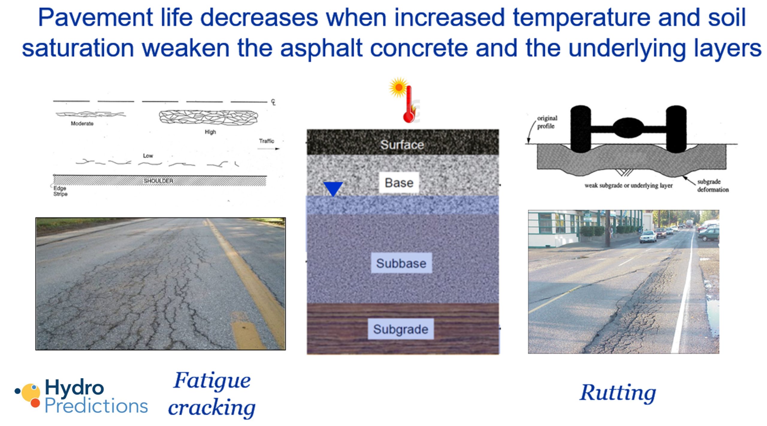
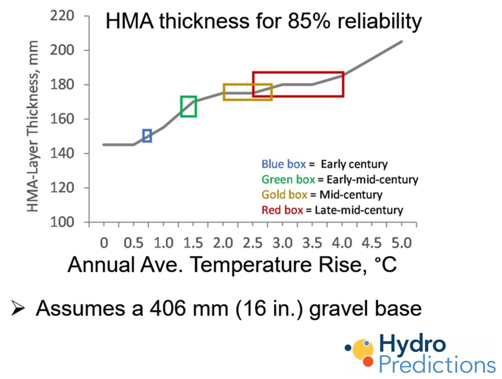
Sea-level rise-induced groundwater rise and temperature increased caused by climate change can reduce pavement life in road infrastructure resulting in more frequent and/or severe rutting and fatigue cracking. This adds to agency repair and maintenance costs as well as user costs in terms of vehicle damage, delays, and reduced safety. HydroPredictions can help you avoid these costs through adequate adaptation planning.
WATER QUALITY
Clean water is essential for human health and the environment. Groundwater is the world's largest distributed source of freshwater and its quality must be protected.
Site assessments
HydroPredictions has worked for government agencies and private industries in assessing, simulating, remediating, and protecting water quality. This work continues with emerging contaminants such as PFAS compounds and pharmaceuticals in addition to solvents, organic and inorganic compounds, pathogens, and radionuclides.
As the climate changes, existing hazardous waste disposal sites will need to be re-evaluated as new conditions mobilize contaminants. In areas where groundwater is projected to rise, policymakers will have to consider new strategies to protect the quality of subsurface drinking water resources.
Risk assessments
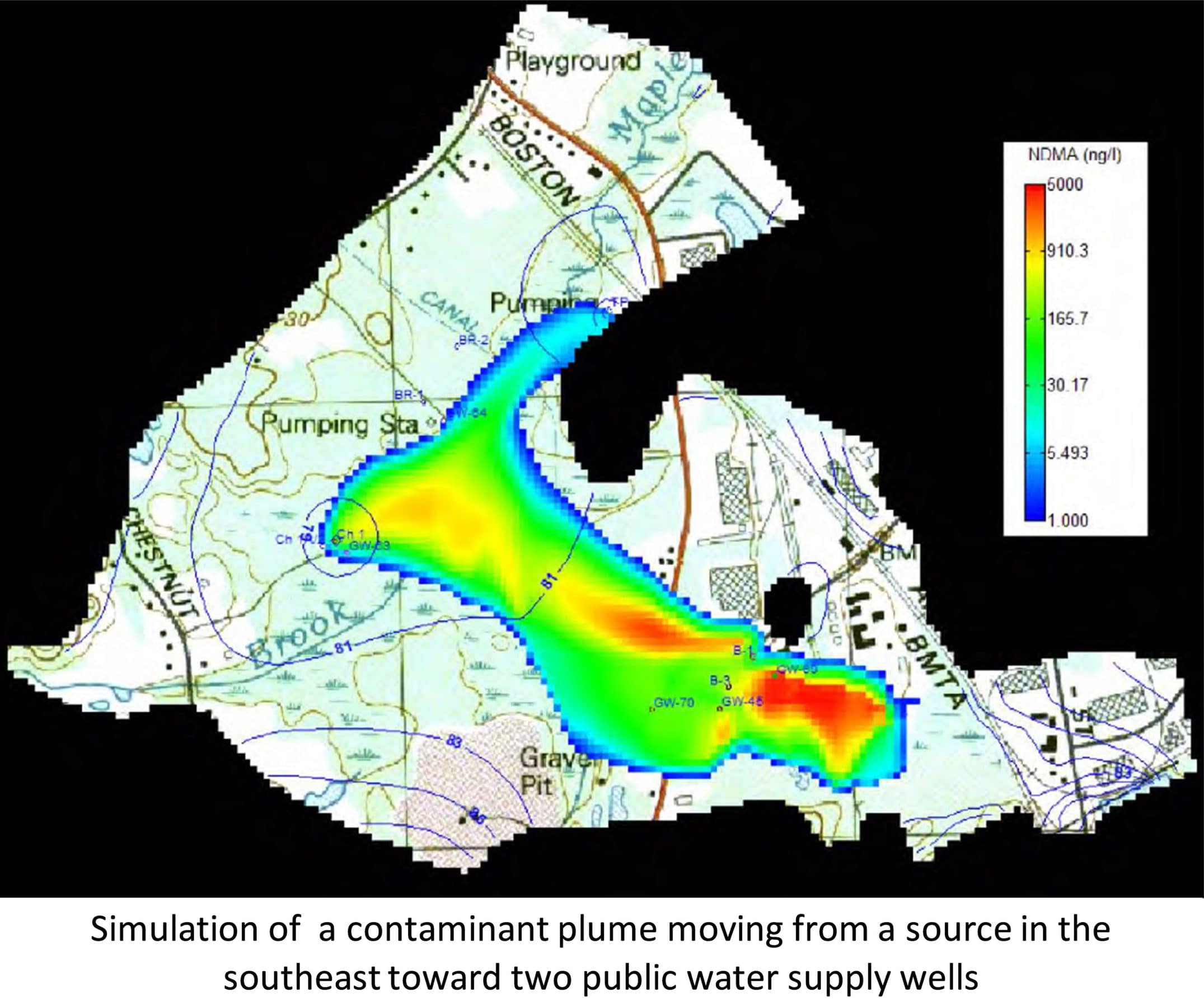
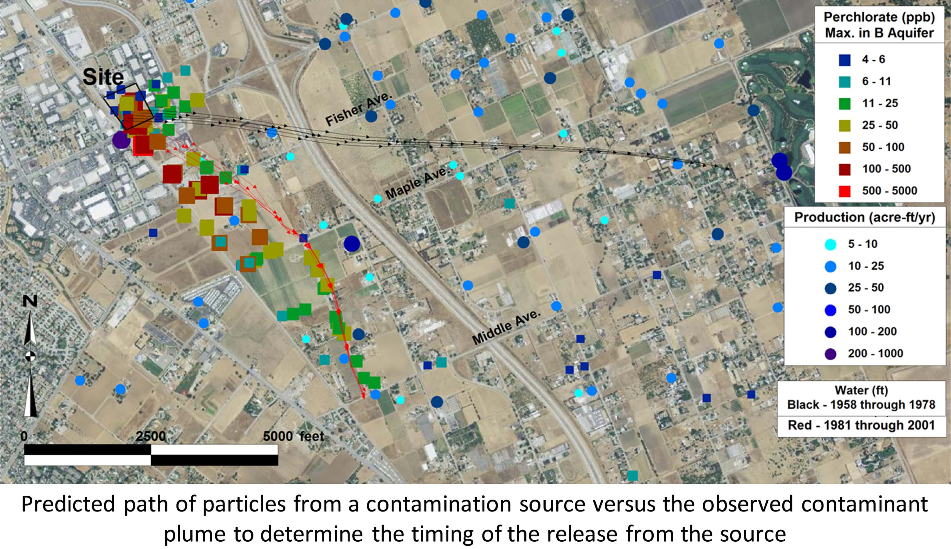
Risk assessments identify sensitive receptors of contaminated soils or groundwater. These may include soils that are easily accessible to people, drinking water wells, pathways to surface water bodies, and emissions in indoor spaces. HydroPredictions can help with risk assessments by simulating contaminant movement, calculating time of travel, and determining remediation time frames.
HydroPredictions will also apply standard risk assessment methodologies to identify risks associated with climate change and sea-level rise.
Evaluation of remediation and adaptation strategies using groundwater modeling
HydroPredictions creates groundwater flow and transport models to simulate groundwater and contaminant movement. Our models are then used to evaluate remediation alternatives. HydroPredictions works with environmental consultants and engineers; federal, state, and local governments; private industry; environmental protection groups; law firms; and insurance companies.
Groundwater models can also be used to determine changes in groundwater levels and flow patterns associated with changes in climate, population, and land use. In the northeastern United States, for example, the frequency and intensity of extreme precipitation events are projected to increase, the duration of the winter season (frozen period) is projected to decrease with temperature increases, and evapotranspiration will increase. These factors will affect drinking water availability and flooding. Our models help communities assess the impact of these changes and evaluate adaptation strategies. HydroPredictions uses a stepwise adaptation planning approach to minimize cost and maximize flexibility.
HYDROLOGICAL SIMULATIONS
Simulations are a powerful and cost-effective tool when planning for the future. They are essential today, because designing for the future using past climate and hydrologic parameters will give the wrong answer in a changing climate.
Groundwater flow and transport modeling
HydroPredictions creates groundwater flow and transport numerical models for clients using USGS Modflow, Seawat, MT3D and Modpath. Model setup and data entry is accomplished using the Graphical User Interface (GUI) Groundwater Vistas.
Input data is analyzed using MS Excel and/or R and GIS. Where available, Lidar data is used for the land-surface and surface-water elevations. Once the model is up and running it is calibrated to trusted data points using standard calibration techniques such as PEST (Parameter Estimation Code). Model parameters are then adjusted (within acceptable limits) to fit the trusted data points. Once the model has been calibrated, it is validated against another trusted dataset that was not used for calibration. Water quality modeling using USGS MT3D is used to simulate contaminant transport and to investigate remediation alternatives. USGS Seawat is used to simulate saltwater intrusion into coastal aquifers. Modpath is used to identify the source of contamination and to determine travel times.
Evaluation of environmental data using data management and visualization software
HydroPredictions analyzes large data sets using Excel, R, Matlab,and GIS for data analysis and the preparation of model input data. We also use Earthsoft's EQuIS environmental data management software for the analysis of environmental data and EnviroInsite for the analysis and visualization of groundwater information. ESRI ArcGIS and Global Mapper are the GIS platforms used most frequently.
At HydroPredictions, we are experienced in accessing and processing downscaled climate data from General Circulation Models (GCMs) for use in our simulations, so that clients can feel confident that we are using the most recent projections when planning for the future.
Drinking water source approval and environmental permitting
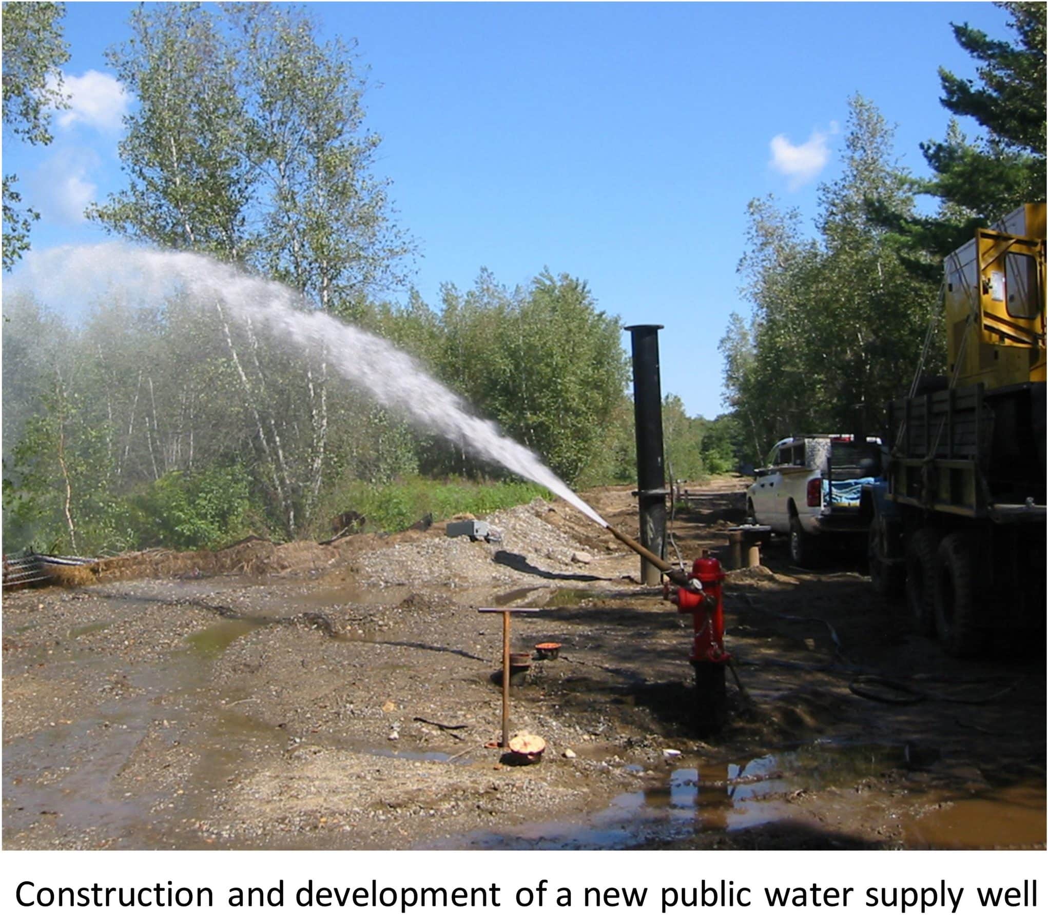
HydroPredictions uses groundwater modeling and pumping test design, data collection, and analysis to assist clients in the drinking water source approval process. Frequently, this work requires numerical simulations to determine safe yields and Zone 1 protection areas. We also work with clients to attain permits for the safe disposal of waste materials.
As temperatures rise and water levels drop in surface-water reservoirs, communities are looking to develop groundwater resources for drinking water supplies. At HydroPredictions, we are well equipped to assist communities, businesses, counties, and regional planning commissions investigate aquifers for water supply, both in terms of quantity and quality.
Storm-water drainage and collection systems
Storm-water management is increasingly a concern for communities dealing with more frequent and extreme rainfall events and flooding from sea-level rise and storm surge. More frequent and intense rainfall events are overwhelming inland drainage systems resulting in urban flooding and health issues. As sea levels rise, saline water backs up in coastal storm-water drainage systems and the ability to get water out of urban areas is impeded. HydroPredictions works with surface-water modeling professionals to identify vulnerable areas and to evaluate adaptation strategies for mitigating higher storm-water flows and the impacts of sea-level rise.
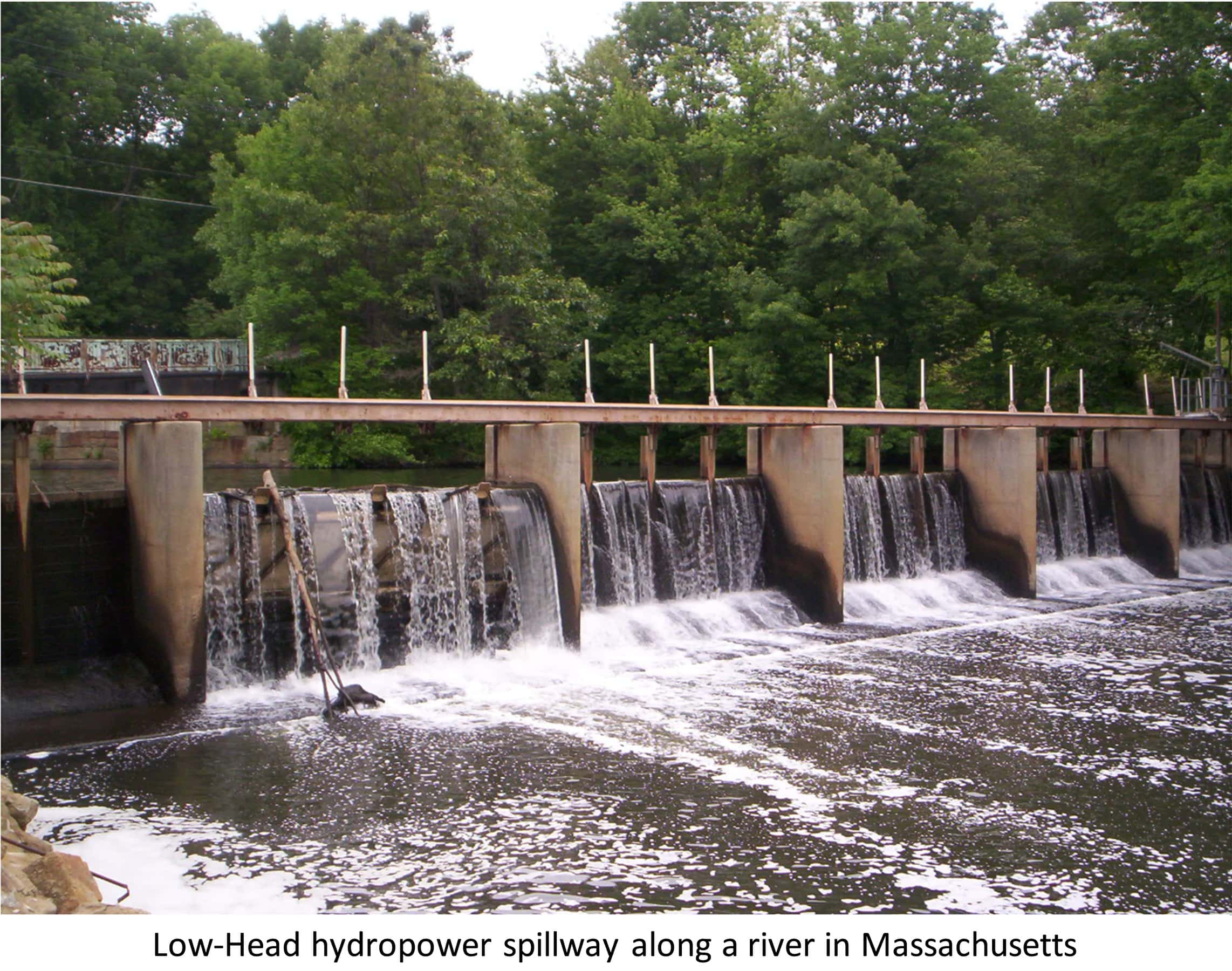
Low-head hydropower licensing
One of the most promising forms of renewable energy is hydropower, however, the Federal Energy Regulatory Commission's (FERC) permitting process is a difficult and long process. HydroPredictions helps low-head hydro developers navigate the regulations and permitting process.

